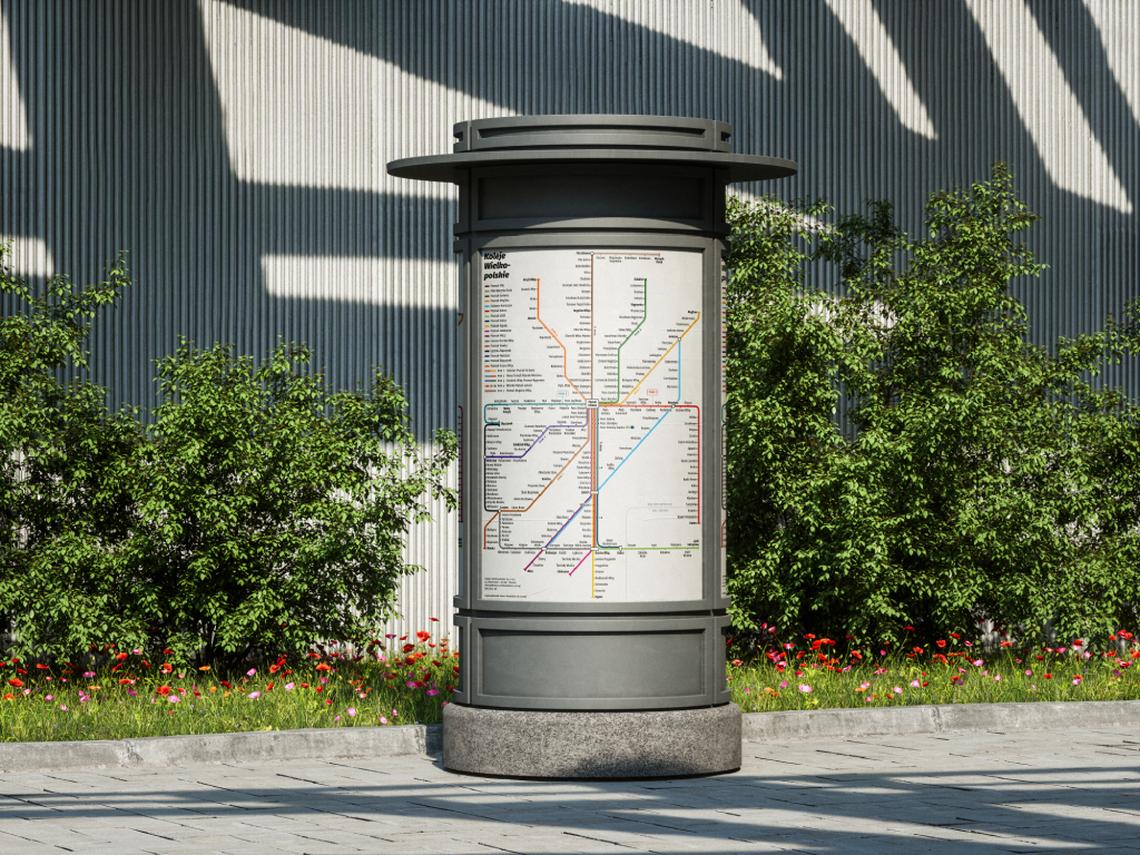
Greater Poland railways map
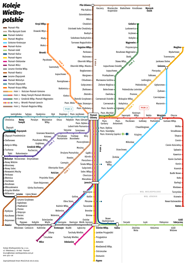
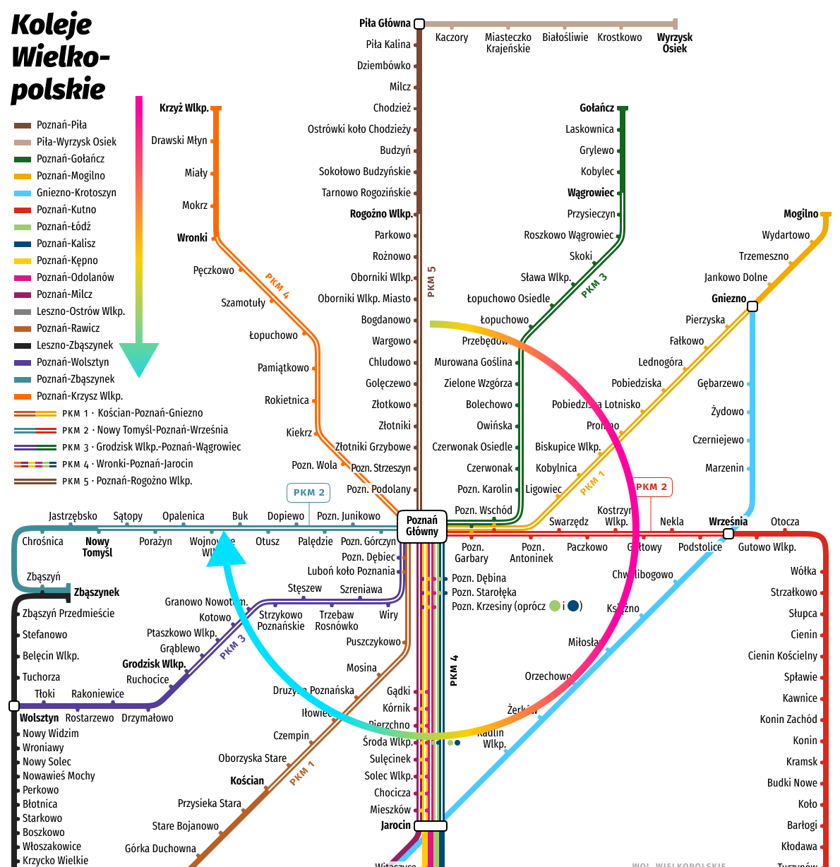
I made a map of the Greater Poland railways that shows all the lines with all the stops on them.
 Download PDF
The map only loosely follows geography. More emphasis was placed on the geometric form of the lines, which makes the map easier to read and remember. For a passenger it is less important to know at what angle a given line runs. What matters more is knowing where you can go on a given route, and which stops the train calls at in the chosen direction. Aligning the lines with one another also makes the map more coherent.
Besides the ordinary routes, the map also shows the Poznań Metropolitan Railway (PKM) services. These routes are marked on a separate graphic layer placed over the main lines.
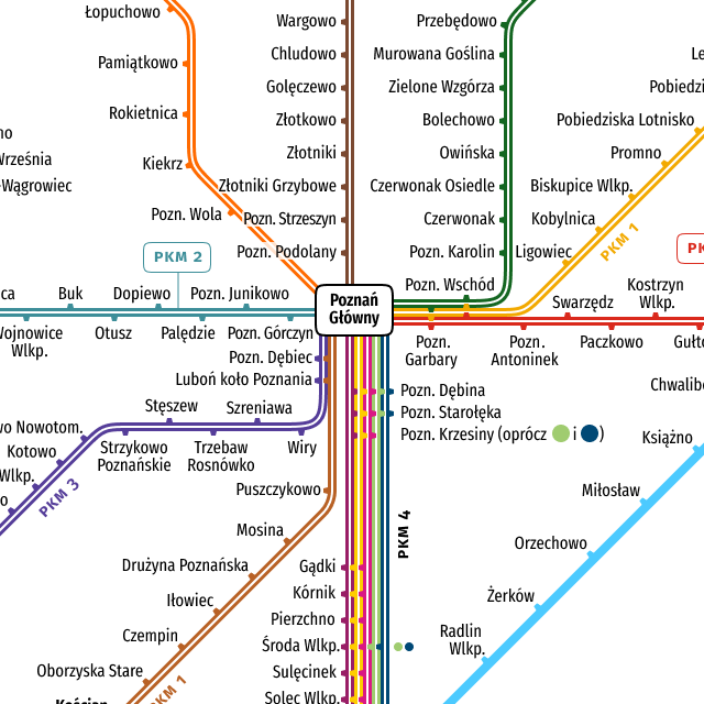
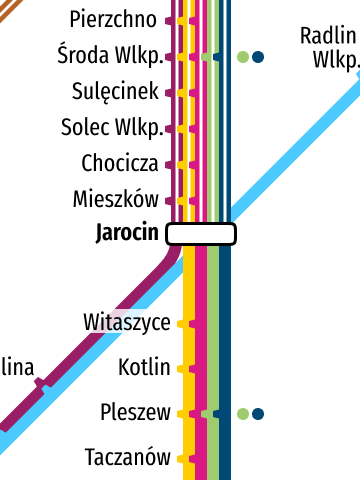
The map also contains small details that make the information easier to read.
Trains that run from Poznań to Nowe Skalmierzyce and to Łódź make far fewer stops than trains on other routes, so there is a chance that a passenger will miss the “stub” that marks the stop in Środa Wielkopolska and in Pleszew. So besides the ordinary stubs that mark a stop, I also added extra circles that draw attention to the fact that trains going to Nowe Skalmierzyce and Łódź stop there as well.
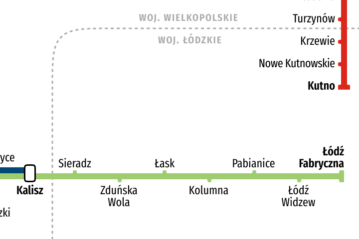
I also added voivodeship borders so that a passenger knows from which stop the Łódź Voivodeship begins.
The legend was also made in a way that makes it easier to follow the map. The labels are ordered according to how the lines sit on the map, reading clockwise.
The project took about a month of unhurried work.